


advertisements


News

Weather
Posted: Apr 24, 2024 3:14 PMUpdated: Apr 25, 2024 10:45 AM
Severe Storm, Heavy Rain Potential Increases Through Weekend

Nathan Thompson
An active weather pattern will bring several chances of storms during the next few days across northeast Oklahoma and southeast Kansas.
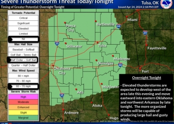
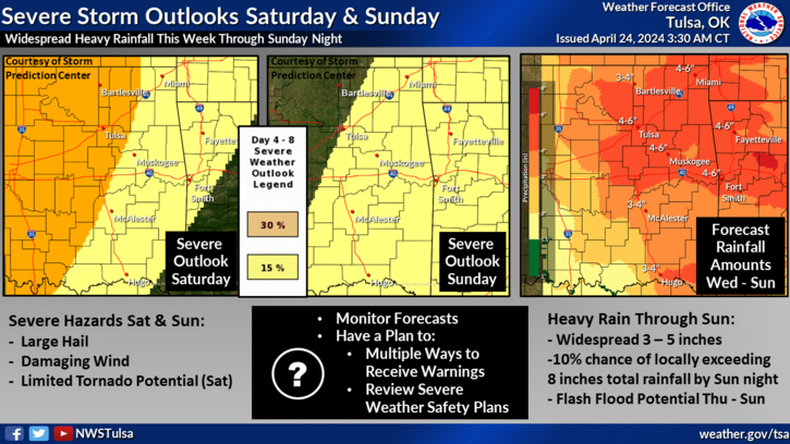
According to the National Weather Service in Tulsa, thunderstorms are forecast to organize and move into the area overnight tonight (Wednesday), which could have a marginal severe potential. Large hail is the primary severe threat with strong winds a secondary threat.
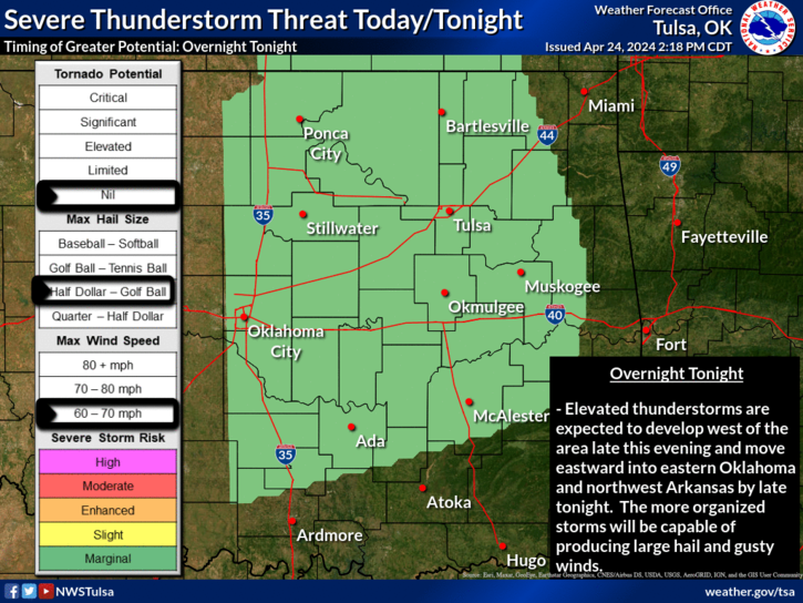
The severe storm threat continues Thursday as thunderstorms are forecast to be ongoing. Additional thunderstorm development Thursday afternoon and evening is forecast as the surface boundary lifts back through the region. Storm chances also continue Thursday night with potential storms out west reaching the area. Large hail and damaging winds are the primary severe threat Thursday and Thursday night.
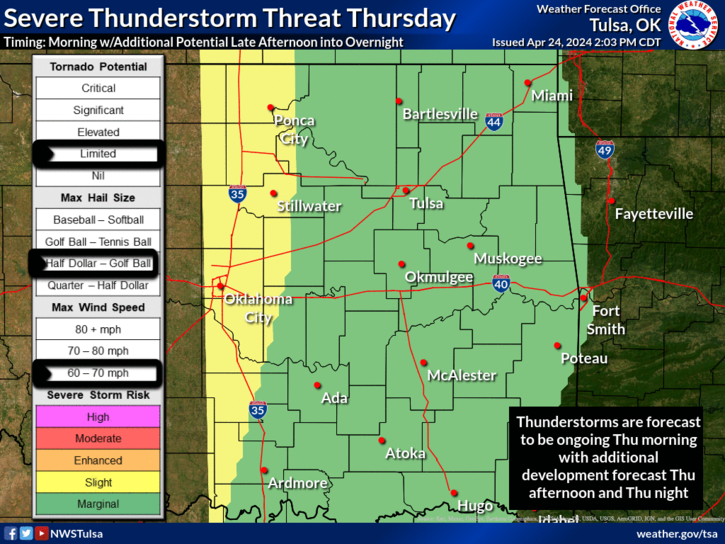
The threat continues again Friday as thunderstorms are forecast in the area. This activity is expected to continue into the afternoon hours as it spreads through the region. Additional thunderstorm development Friday mid- to late-afternoon will be dependent on the amount heating and destabilization that can occur Friday afternoon. All modes of severe weather, including a limited tornado threat will be possible Friday.
An active spring weather pattern continues through the weekend with multiple rounds of storms likely, including the potential for severe weather. All modes of severe weather are possible Saturday. Also, with the multiple rounds of storms through the weekend, heavy rainfall with widespread 3 to 5 inches are forecast with locally higher amounts.
Details will be refined and the forecast will be updated throughout the next few days.
« Back to News