


News

Weather
Posted: Apr 24, 2026 9:51 AMUpdated: Apr 24, 2026 9:51 AM
Severe Weather Threat Continues Saturday, Sunday

After a stormy Thursday night, more severe weather is expected Saturday and Sunday.
The frontal boundary that moved through Thursday night is expected to lift back northward Saturday afternoon and night, which will aid in increasing thunderstorm chances for northeast Oklahoma and southeast Kansas.
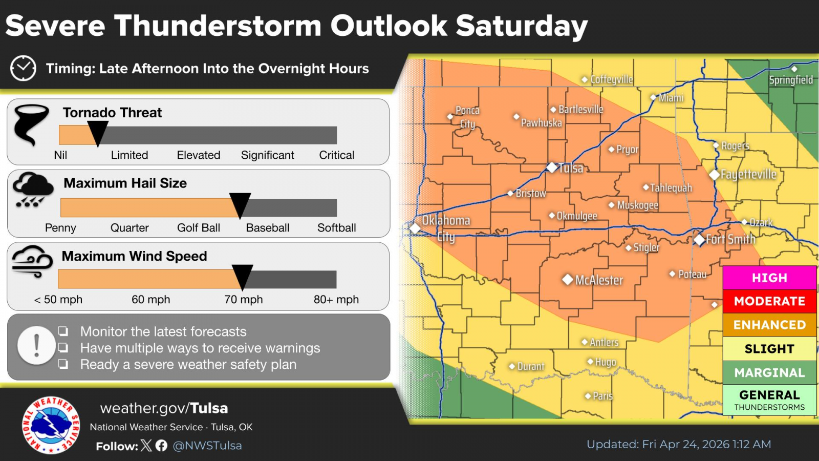
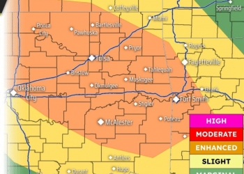
A Level 3 of 5 severe risk zone is expected across the listening area Saturday afternoon and evening, with a Level 2 of 5 zone in Montgomery County, Kan. Large hail and damaging winds are the primary severe threats.
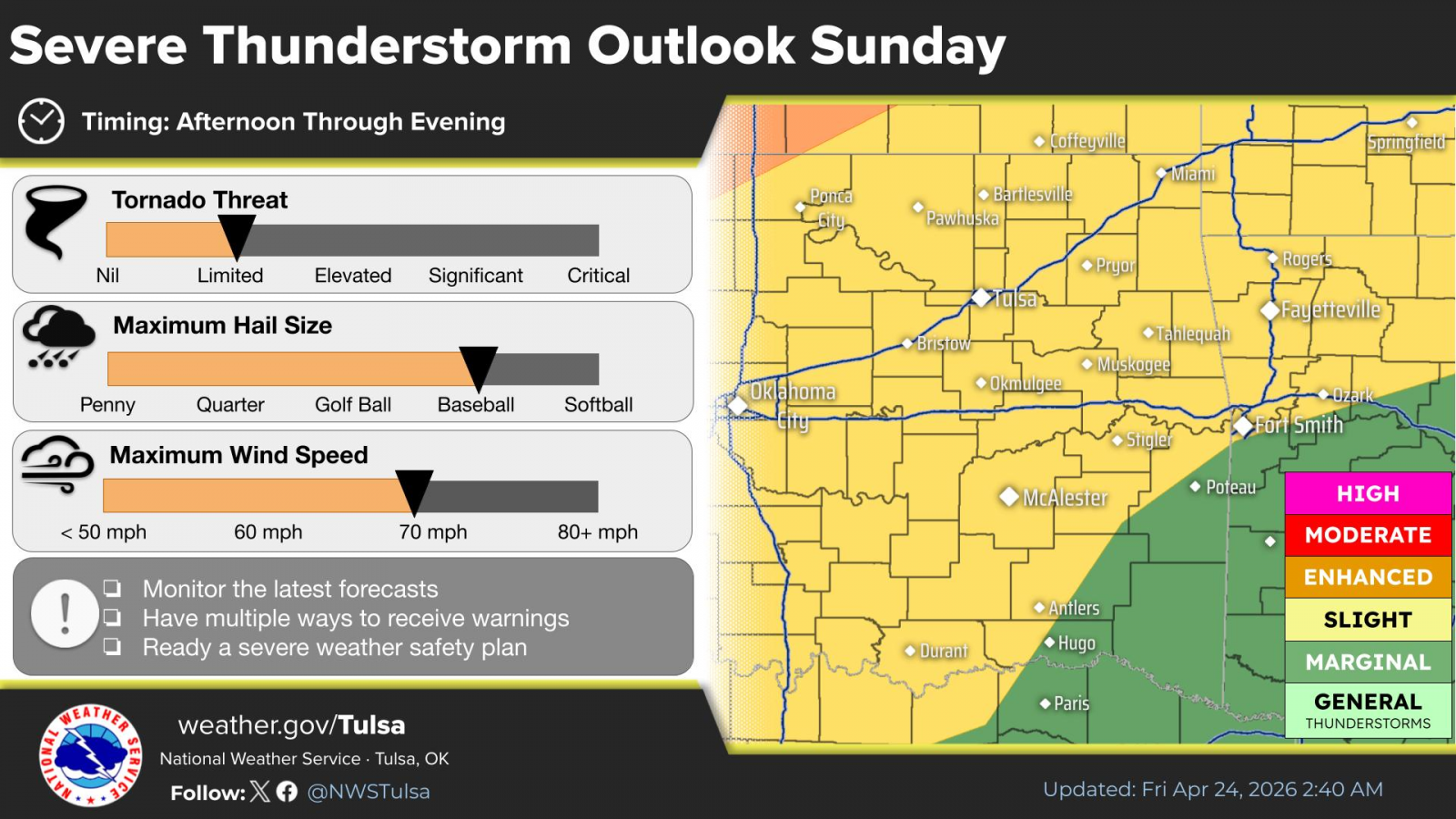
Strong to severe thunderstorms will once again be possible from Sunday afternoon through the evening hours. Uncertainty remains in how widespread coverage of storms will be. A Level 2 of 5 risk area is expected. However, any storms that do develop with be capable of all severe hazards including large to very large hail and a few tornadoes.
« Back to News